What real estate aerial photography shows that ground photos can't
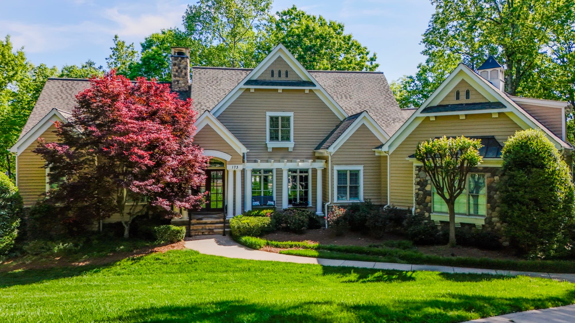
A handheld photo shows a room or one side of a house. An aerial shows the whole story: lot size and shape, how the home sits against the street and the neighbors, the backyard, the pool, the acreage, the wooded buffer. For a Lake Norman waterfront listing or an acreage property outside town, that context often decides if an out-of-town buyer keeps scrolling or calls.
Altitude flatters the property, too. From the right height I can frame a roofline cleanly against the tree canopy and put the house in its setting in one composition. The photo reads as premium, and buyers arrive already understanding the scale.
Listing-ready stills and video, edited by me
Every flight comes back as finished work, never raw files. You get color-corrected stills cropped and sized for MLS photo specs, Zillow, social, and print, plus edited aerial video when you want motion for a property reel. I plan each flight around the property so the hero shots get captured the first time.
Turnaround is fast because there's no lab between us. I shoot it, I edit it, you post it. Aerial coverage shouldn't be the thing holding a listing back from going live.
Built around Charlotte agents, brokers, and property owners
My background is landscape design and site planning, so I read a property the way a buyer eventually will: lot, grade, access, and how the home relates to everything around it. That changes how I frame a parcel, not just a building.
I shoot residential listings, luxury and acreage properties, new construction, land, and commercial real estate across the Greater Charlotte area. Some agents bring me one unusual property. Others want consistent aerials across a whole portfolio. Either way the goal is the same: imagery that makes the property understood and remembered.
Fully insured, FAA-compliant flights
Every flight is FAA Part 107 compliant and fully insured. That protects you, the property, and the listing, and it means flights in controlled airspace around Charlotte get authorized properly instead of flown on a hope.
Compliance matters to me beyond the checkbox. It's what lets a brokerage use the imagery for commercial marketing knowing the work was captured legally.
What you get
- Color-corrected aerial stills sized for the MLS, Zillow, social, and print
- Edited aerial video for property reels and brokerage marketing
- Overhead and angled views covering the full lot, home, and surroundings
- Hero exterior shots that frame the property in its setting
- Fast turnaround so the imagery is ready before the listing goes live
- FAA Part 107 compliant, fully insured flight on every shoot
How it works
- 01Tell me about the property
Send the address, the listing timeline, and what makes the place special (acreage, waterfront, views, outbuildings). I'll build the shot list around it.
- 02I plan a compliant flight
I confirm airspace and any authorization for the location, watch the weather, and map the angles that will make the listing strongest.
- 03On-site capture
I fly the property and shoot the planned stills and video, adjusting on site for the best light and composition.
- 04Edited delivery
I color-correct and cut everything myself, then deliver listing-ready stills and video sized for the MLS, web, and social. Fast.
Real Estate Aerial Photography FAQ
Do you have the proper certification and insurance for commercial real estate photography?
Yes. I'm FAA Part 107 certified and fully insured. Paid drone work, including real estate photography, legally requires a Part 107 certificate, and every flight I fly meets that standard.
What do I actually receive, and how fast?
Finished files: color-corrected aerial stills sized for the MLS, web, and print, plus edited aerial video when you ask for it. I turn shoots around fast so the imagery is ready before the listing goes live.
Can you fly anywhere in the Charlotte area?
I cover the Greater Charlotte area. Some addresses sit in controlled airspace near the airport and need FAA authorization first. I handle that planning so the flight stays legal and on schedule, and if a property sits in truly restricted airspace, I'll tell you up front.
Do you shoot both photos and video?
Yes. Most listings lean on stills, but I also cut aerial video for property reels, brokerage marketing, and social. Tell me what you need and I'll plan the flight to capture both in one visit.
What if weather is bad on the scheduled day?
I don't fly junk conditions. Flat gray light or unsafe wind means we reschedule for the next clean window, because a dull aerial doesn't sell a property and an unsafe flight helps nobody.
How do I book or get a quote?
Email shane@sqoskyworks.com or call (704) 783-6767 with the property address and your listing timeline, and I'll plan the shoot.


