What Aerial Site Documentation Captures
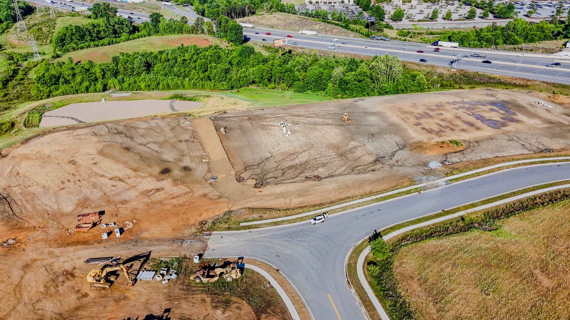
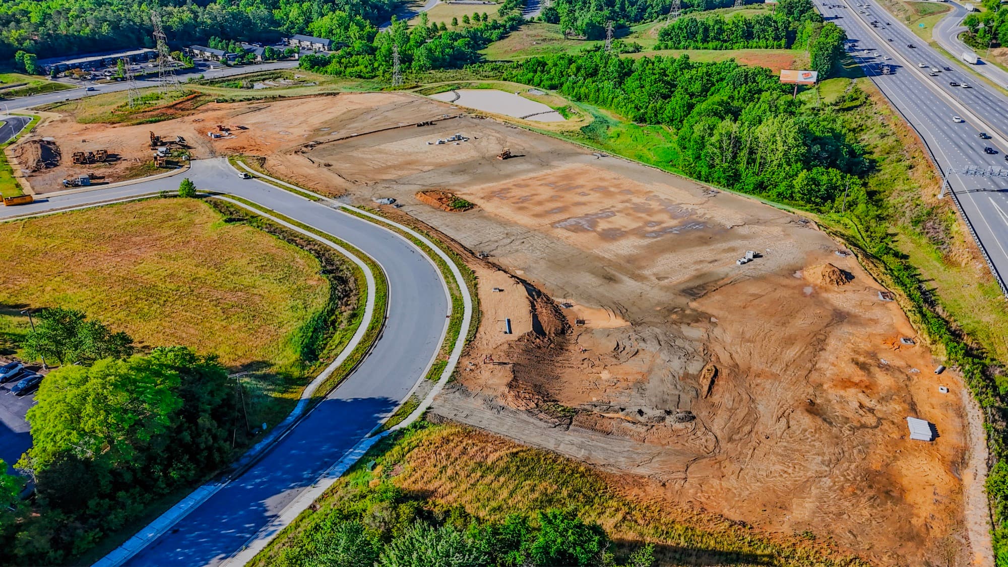
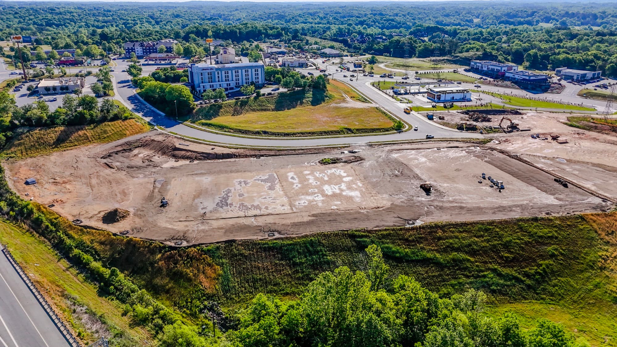
Site documentation answers one question: what did this property look like on this date? From 200 feet up, the whole story fits in frame. Structures, grading, drainage, staging areas, where the gravel ends and the red clay starts. Ground photos taken from one corner of the site can't do that.
I shoot overhead and oblique angles so the record covers the footprint and the context around it. When a question comes up later (an encroachment, a drainage complaint, a neighbor who swears that fence was always there), everyone looks at the same dated imagery instead of arguing from memory.
Why a Dated Record Matters in Charlotte
Charlotte doesn't sit still. Parcels get cleared, graded, and built out fast, and the conditions you saw last month may already be gone. A baseline set of aerials before work starts protects everybody involved. So does a set at handover.
I fly under FAA Part 107 and I'm fully insured, so the record holds up as professional documentation. My background is in landscape design and site planning, and that shapes what I point the camera at. I'm after the angles and details that matter for a property decision, not just pretty footage.
Files You Can Use the Day You Get Them
Documentation only helps if it's organized. I color-correct the stills, cut the video, and hand back files that drop straight into a report, a presentation, or a project folder. No raw dump to sort through.
If the site needs repeat visits, I fly the same paths and framing each time so the sets compare cleanly side by side. Turnaround is fast. If you need the record for a meeting next week, you'll have it.
What you get
- Color-corrected aerial stills shot from overhead and oblique angles
- Edited aerial video covering the full site, surroundings, and access points
- Coverage of structures, grading, drainage, staging areas, and neighboring parcels
- Dated imagery that sets a clear baseline of existing conditions
- High-resolution files organized and ready for reports and project records
- Repeatable flight paths and framing so return visits compare cleanly
How it works
- 01Scope and schedule
Tell me about the site and what you need on record. We'll figure out the angles and features that matter, then I'll get you on the calendar anywhere in the Greater Charlotte area.
- 02I fly the site
I capture overhead and oblique stills and video of conditions, surroundings, and access. Every flight is FAA Part 107 compliant and fully insured.
- 03I edit everything myself
Stills get color-corrected, video gets cut, and I review every file so it's sharp, well-framed, and usable.
- 04Fast delivery
You get organized, finished files quickly. Ready for reports, stakeholders, and the permanent project record.
Site Documentation FAQ
What is drone site documentation?
It's a dated set of aerial stills and video that records a property exactly as it looked on the day of the flight. Think of it as an objective reference for planning, communication, and recordkeeping. Ground photos can't match the coverage.
How is site documentation different from construction progress documentation?
Site documentation captures one point in time, like before a project starts or at handover. Construction progress means I come back on a schedule and build a timeline of the work. Plenty of clients use both, and I offer each as its own service.
Is SQO SkyWorks licensed and insured to fly?
Yes. I'm FAA Part 107 certified and fully insured, and every flight throughout the Greater Charlotte area is flown to that standard.
What do I actually receive?
Color-corrected stills and finished video, organized so they drop straight into reports, presentations, and project records. I turn files around fast so you have them when you need them.
What areas do you serve?
I'm based in Charlotte, NC and fly throughout the Greater Charlotte area. Email shane@sqoskyworks.com or call (704) 783-6767 and we'll talk about your site.
How do I schedule a documentation flight?
Reach me at shane@sqoskyworks.com or (704) 783-6767. Tell me about the site and your timeline, and I'll plan the flight from there.